Saturday, January 18, 2014

4 Days in the Owens River Gorge

The Owens River Gorge is California largest sport climbing crag. It's important for the reader to understand the difference between traditional rock climbing and Sport Climbing. I shot the photo below of the gorge from my Fresno-Vegas flight one fall afternoon.
 
 
The gorge contains something close to 500 sport climbs and 100 gear climbs. Short story - this place is nuts for sport climbing. Situated between Mammoth and Bishop, the ideal time to climb is pretty much every season except summer. Winter temps are chilly at night but perfect (t-shirt) conditions during the day. The gorge also has a lot of non-climbing related history which I think is totally fascinating. The gorge history pertains to top of the LA aqueduct. I won't talk about that here but needless to say it's a very interesting story.
In April of 2012 Kristine and I did a recon trip to the gorge and other rock crags in the Owens Valley. We didn't really climb that much but I did get a good overview of the place.  

 
As far as climbers are concerned the Gorge is divided in to 6 sections. North, Upper, Inner, Central, Lower, and Sub with the bulk of climbing in the Central Gorge.
A little background story to why I took this time to go to the gorge. You see the original plan was to take a Level One Avalanche course from Sierra Mountain Center in Mammoth. However with an extremely dry winter in the sierras there was not enough snow to do the course. So instead I decided to pull off a last minute trip to the gorge.
 
Saturday January 18th:
I left my house in Fresno during the afternoon to get the 6 hour to Bishop out of the way. This was my first trip with my new truck - The Taco. I got the The Pit campground my home for the next couple of days. This place has the vibe of Camp 4 in Yosemite. Temps at night were a little on the chilly side... in the teens.

 
I secured a partner for my first two day in the gorge from MP while Ivy (my normal partner) would join me for the last two days.
 
Sunday January 19th:
First stop - The Warm Up warm. This wall is home of a lot of easier routes for the gorge. The wall by 10am was already pretty full with climbers.

 
Across the river some interesting belay platforms...

 
A climber is seen here on From Chocolate to Morphine a 5 star .11D climb.

 
Later in the day we ended up at the Great Wall of China. Who did we see there??? The one and only Peter Croft!


Monday January 20th:
We spent most of the day climbing at the Pub Wall followed by the Banana Belt. The day was finished with climbing a strenuous .9 called Paradise.

 
Tuesday January 21st:
Ivy showed up at the Pit campground and we decided on exploring the Lower gorge. The lower gorge rock quality was pretty sub-par. We found only a handful on interesting climbs.
 
Wednesday January 22nd:
After 3 straights days of climbing my arms were a little blown out. We again decided on exploring a different section of the gorge. The Upper and Inner gorge have a much more wild and scenic feel compared to the Central and lower sections.


In the pic below the Gorgeous Towers are seen.

 
Old Mining equipment.

 
More of the Gorgeous Towers.

 
We only ended up climbing just one routte for the day. We had more of a exciting hike that at times felt like a canyoneering trip.
I had fun time at the Gorge but walked away with a feeling that I just wasn't strong enough to climb there. ORG really has the feel of climbing at the gym...not much technique required. I'll quit complaining... it was still a fun time!
 

Monday, July 29, 2013

Middle Palisade - Northeast Face

Previously attempt on the East Face: September 2010

It been almost 3 years since Russ and I first attempted the Middle Palisade. Stoke was high and our skills and straights significantly better than before. I know that sounds like an RPG video game description but seriously, what we knew now compared to 3 years prior was night and day.
Our trip would be nothing more than a 2 day blast. The plan...

  • Day #1: Drive back to the east side and hike are far as we could up the South Fork of the Big Pine.
  • Day #2: Alpine start, keep it light, keep fast, and climb the Northeast Face of the Middle Pal. Hike out, drive home.
Monday July 29th 2013:
Joining up for the hike up the south fork of the Big Pine was Russ's friend Margo. We all arrived at the trail head (same as North Fork) about 5 PM in the evening. No need to get an early start for this trip. We were only traveling up the trail a few miles to mostly to gain some altitude for night to take the edge off.


Within the first few miles we came across an obstacle that was really unexpected to be honest with you. For the preceding few days, heavy monsoonal rains had been hitting the Sierras. Consequently, the south fork of the Big Pine was rushing and overflowing its banks. Unfortunately, the bridge across the river was washed out in 2011. The depth and speed of the creek was really unnerving for Margo and I. Fearless Russ however went in first and crossed unscathed. My crossing was cold and deep but not that bad. 


You can see from the picture below that the water came almost up to  my chest. We had to strip down and carry our pack above our head along with boots etc.


We reached an elevation of about 9,600' as the sun went down and found a nice campsite prior to the trail steeply going uphill to Brainerd Lake. It was a very mellow night with cooked brats and a campfire.


Tuesday July 30th 2013:
Russ and I launched from our camp about 5 AM to a very mild temperatures. The first hour up the trail was pretty uneventful short of getting lost for a few minutes near a creek crossing and unable to find the trail turn by headlamp. We kept a fast past for the first few hours moving quickly by Brainerd Lake and then the insanely gorgeous Finger Lake.


By 7:30 in the morning we had reached the base of the Middle Palisade glacier.


Now if you'll read my September 2010 trip report, you'll know that the issue was finding the START of the route. In particular, the crossing of the glacier to the face proper. Our mistake 3 years ago was to get sucked into the "reddish" band of rocks because it had been mentioned  in guide books. The truth is, there is a 3rd class ramp that is not very obvious from a distance. In fact, the true crux of the East Face route is CROSSING the bergschrund of the Middle Palisade glacier.


This time around, instead of hiking up to the top of the moraine pile that splits the glaciers, we moved onto the left glacier about 200 feet from the top moving upward and left towards a ramp on the face. Generally speaking, nobody goes onto a glacier with crampons and ice axe but we found the sun cups the be largest enough to step and balance into without slipping out on the ice. Pictured above is a shot looking back on the glacier and bergschrund crossing to the 3rd class ramp. It should also be noted that this gap varies as the season goes on. We found it to be at about maxed out for safe jumping distance. Also like any crevasse crossing, it could be tragic if one fell in. The depth had to be over 20 feet deep or perhaps more to the bottom. The ramp climbed up about 100 feet, rounded a corner into a small gully which eventually lead into one of the main gullies than can been seen on the East Face.


Above: The view back on the Middle Palisade glacier. 
Below: A HUGE gendarme!


Above: Looking down the main gully which ascends the east face of the Middle Palisade. What looks like a garbage chute from below was surprisingly clean rock. In fact, we didn't experience any loose rock!
Below: I know...it doesn't looks class 3, but believe, it was and it was a blast!


Above: The last hundred feet of the gully are blocked by a head wall. This can be bypassed on its left (Not the direction Russ is going...lolzzz).
Below: 5 and half hours later we pull on to the summit. Awesome summer sierra weather with a light breeze and incredible views!


Above; Another party just happened to be climbing in gully at the same time. We all got to share an very cramped summit. The good news is we got a photo op of the both of us which is rare.
Below: Russ taking in the sights on the small summit of thee Middle Palisade (14,040').


We hung out the summit for about 30 minutes soaking up the view prior to descending the same route. The trip back down to the glacier took about an hour. Again, I was very thankful there was no loose rock in the gully for the collective 5 people in this chute. Pictured below is a zoomed in detailed pics of some of the crevasse on the Middle Palisade glacier.


The trip back to camp where Margo was hanging was long and drawn out from the full days worth of energy spent. I arrived slightly behind Russ back to camp at 4 PM making for almost a 11 hour round trip from the camp. We quickly packed and left back down the trail as a group. The creek crossing was still an undertaking but not as bad as the previous day. The 3 of us arrived back to the car at the trail head after 6 PM and then rallied to crank out the drive home to Fresno.


OK, so completed California 14ers....
  • Mt. Whitney - July 2009
  • Mt. Shasta - May 2011
  • Mt. Williamson - June 2011
  • Mt. Sill - May 2012
  • Mt. Russell - June 2013
  • Middle Palisade - July 2013
...on to the next Mountain!

- Aaron

Friday, June 28, 2013

The East Ridge on Mt. Russell - II 3rd Class

Still buzzing for my summit of Mt. Rainier a few weeks earlier I was itchy to go out get some some Sierra granite. I also wanted to continue on my quest to summit all of California's 14ers.
To date I've summited:

  1. Mount Whitney
  2. Mount Shasta
  3. Mount Williamson
This trip was also an opportunity to get in a car camping trip with Kristine and our dog. My plan was to get in a car-to-car summit of Mount Russell via the famous East Ridge route while Kristine spent the day hiking around the Whitney Portal area. We would then continue along on our camping trip afterwards.

Mount Russell sits at 14,086' and is directly across from Mount Whitney. Although located very close to Whitney it is climbed via a completely different drainage and only shares the Whitney trail for the first mile out of Whitney Portal. Many popular technical routes ascend Russell's south face such as:
However, all those routes were out of the question since I was doing a car-to-car solo of the mountain. My objective would be the East Ridge route. This route is generally considered the BEST 3rd class route in the entire Sierras. In my readings, I have perhaps found only one person say the East Face of the Middle Palisade a little bit better.
  • Russ and climbed the East Face of the Middle Palisade the following month. Trip Report Here.
SuperTopo's description of the East Ridge is as follows:
  • "With a striking line, big exposure, and great rock, the East Ridge is one of the best 3rd class routes anywhere....overall this one of the best 3rd class routes you will ever do."
Peter Croft's The Good, the Great, and the Awesome:
  • "This is one of the very best class 3 climbs that I've done anywhere..."
This mountain is not a give-me by any means, especially when done car-to-car. This route involves over 5 miles of cross country travel with 6,000' of elevation gain from Whitney Portal. I was expecting this to be a huge day but felt up to the task being in great shape from climbing and lots of running.

Friday June 28th 2013:

Kristine, Nala (our dog), and I drove over to the Owen Valley that afternoon. I knew that the Whitney Portal campground was long ago sold out so I planned on us staying at Lone Pine campground. We had no problem getting a spot when we arrived but there was a reason for that. The campground is located still in the Owens valley and consequently it was still very hot in the desert that afternoon. The only relief came from afternoon thunderstorm clouds over the Sierras.

  • A word about the photos in the trip report. I just got a Go Pro the previous month from Kristine for my birthday. I was still playing around with it. Some photos are cool, some not so much. But the only photos I got for this trip come from Go Pro.


Although mega hot, it eventually cooled down enough in the evening to relax. Kristine made an awesome spread for dinner that night.

Saturday June 29th 2013:

I awoke from out still warm tent at 4am to silently eat my oatmeal and coffee. I awoke Kristine and she drove me up to the Whitney Portal trail head and by 5am I was off hiking up the hill. The temperature was warm for that altitude and knew this was going to be a hot day.

The route to Russell ascends the North Fork of Line Pine Creek. For those of you who are familiar with this area, the Mount Whitney trail actually ascends the south fork of the creek. After one miles (2nd creek crossing) on the Mount Whitney trail, the "cross country" portion of the trip begins. Except that this is such a popular location to go to since assess to not on Mount Russell of all the technical climb of Whitney plus the uber popular Mountaineers Route are all on the North Fork "use trail". I found this trail better than some maintained trails I've hiked on in the Sierras and route finding was a breeze.


The sun came up with in 45 minutes of hiking a I could feel the temperature begin to climb as well. I attempted to make the best pace I could to beat the low elevation heat. This first cross country crux so to speak comes fairly quickly while ascending the North Fork. Although the use trail is in good shape there is a section know as the "Ebersbacher Ledges." This a about a 200' section of 2nd to 3rd class ledges which climb the northern wall of the drainage to a higher bench. The logic behind this is that the willows and undergrowth in the canyon become to dense to make forward progress. The route is heavily marked with cairns.
By 6:30 I had arrived the Lower Boy Scout Lake (10,330') and I took my first break of the day while continuing to watch the sunrise.


Following my break at Lower Boy Scout Lake, the use trail begins the fad and then reappear in several different sections. This is because as time goes on more and more parties pick and choose different approaches. I was aware that the 2nd route find crux was approaching on my hike to Upper Boy Scout Lake (11,500'). With that said, I fell for the 'old sucker use trail'. Let me try to describe to you what these are. Anytime you're on a use trail it's always important to remember that aggressive turns or stream crossings are not marked in any shape or fashion. Again, it's standard practice that people will leave small rock cairns to mark the way or change in direction. However, if the change in path is too commonly missed then the bulk of people continue traveling on making a well defined path. But.... as time goes on more and more start piecing it all together that they missed the 'turn' so to speak. At this point they turn around and the path is not so defined anymore. Only those who have not figured that out yet press on. But the trail keeps getting worse and worse until on the most "navigationally challenged" are left bush wacky wondering where the hell the trail went. By this time you're so far past trail change that when one begins to backtrack they can't actually tell where real use trail comes back in. This is know as a sucker trail.
Well, I got suckerd... even the guide book warned against it. I knew that the path eventually crossed the creek to the north side but with that said, wasn't sure how high up it did that and my "path" was so well used. Even as it began to fad (hint hint) I thought I was on the path.After bushwhacking a little to again find the path (huge hint!) I thought I was about to cross the creek. Finally, I reach a 10' tall thicket of willows and realized it was game over and I had followed the sucker trail. How many poor souls before me had done this?
Instead of backtracking perhaps 500' back down this path to hopefully find the correct path, I made the executive decision to just barrel directly across the Willows. From my vantage point high on the south side of the drainage, I assumed they were perhaps 4 to 5 feet deep. I spent the next 15 minutes in initially waist deep brush followed by 10' deep willows with creeks running though them. Visibility was almost zero trying barge forward though this massive thicket. After getting both shoes soaked and burst out the north side of the thicket on the slab to see rock cairns marking the path. I had to take time to collect myself and let my shoes dry out. This whole process set me back over an hour on my pace. 


Seen above: Looking back at the brush thicket that I crossed. The water fall across on the cliff was my entry point. Lordy... that was rough in there.

After drying out my shoes and getting some more food, I was back on the path to Upper Boy Scout Lake. The next challenge in the approach to the East Ridge comes in the form of a 1,500' scree gully up to "Russell-Carillon Pass" which is class 2. Combined with the high elevation, this is one of the more exhausting scree climbs I've seen in my time. Pictured below is looking down on the end scree. Way across is the North Ridge of Lone Pine Peak (12,949').


4 and a half hours after leaving the trail head I arrived upon the high plateau that ascends to Russell-Carillon Pass. The views of the eastern face of Whitney and massif were amazing!


Below is an annotated topo of the Fishhook Arete on Mt Russell, however, it does does the extended East Ridge coming off the high point summit.  The Russell-Carillon pass is located just right off the photo and the route climbs westbound along the ridge. Mount Russell has two summits but the west point is the technical high point meaning a long traverse for me.

(Photo Credit: Mark Thomas)


By 11:30, I was on the ridge proper and was completely amazed how quickly the exposure picked up. The ridge has tremendous drop offs on both the north and south sides. Per the guide book, all technical impasses could be bypassed on their right (north side) to keep the route class 3.


Above: On the East Ridge looking across to the North Face of Mount Whitney.
Below: Somewhere on the East Ridge


Above: Looking back towards Tulainyo Lake (12,848').
Below: Just before 1pm, I made the west summit making for my 4th California 14er summit! Whitney is pictured in the background.


Although I had made pretty good time up to the summit (7 hours), the altitude and exhaustion had kicked in so my descent was much slower than I wanted. It took almost two full hours to descend back to the pass. From here it was another 6 long hours back down the hill to Whitney Portal. On the plus side I did get a chance to notice exactly where the use trail crossed the stream below Upper Boy Scout Lake. A HUGE building size boulder passes near the trail, turns out this is wear the trail quickly ducks into the brush and crosses the stream. Noted.

13 hours after leaving the trail head I arrived back at Whitney Portal where Kristine and Nala where awaiting my arrival. We all drove back down to our hot campsite in the desert and shared stories from our day. 

Takeaway: This was a most pleasant route! The quality of the rock is superb with amazing exposure. Sticky rubber shoes never once needed nor wanted. The only draw back (besides altitude) was the 1,500' scree trail up to the pass. Still a huge day for car-to-car but short of camping at Upper Boy Scout Lake, going light and fast works really well for this route!


Thursday, June 28, 2012

North Arete on Bear Creek Spire - III 5.8

My climbing partner for this trip was the now infamous missing persons Matthew Greene. Matt went missing near the Mammoth area on July 13th 2013, about one year after we climbed the Bear Creek Spire.
Here are several links to the still ongoing search for Matt:

Our day was 15 hours car to car, one of my longest days in the Sierras yet. Matt being in good shape shook it off as another day. We chatted almost all day while we could. He was a school teacher from Pennsylvania who would take a road trip every summer out west. He had interesting insights to philosophical and spiritual ideas which made our long day seems to fly by. In particular, he was a long distance running and at that time, I was just about to run my first half marathon race. I accredit our conversation that day to taking my running to a whole new level. He alone put the idea in my mind to run a full marathon in which I did about six months later. 

Truth be told, I wasn't even aware that he was missing. I was aware of a missing person and the associated hype when the event happened. Many people going missing in the Sierras every year, some found, some never. Honestly, the name didn't ring a bell for the first year, only until I starting realizing this was the "teacher from Pennsylvania" did I realize who it was. 

Anyhow... this is the story of our day on the North Arete of the Bear Creek Spire.

The Bear Creek Spire (13,720') is one heck of an iconic peak in the Sierras. I think it rivals mountains like Temple Crag and the east face of Whitney. The background logo to one of my favorite beers is the Bear Creek Spire. Check it out, Epic IPA. Located along the Sierra crest it makes the headwaters of course the Bear Creek which flow west towards the San Joaquin and Rock Creek which flows east down towards the Owens. 

I'm going to go out on a limb and say about 99% of people approach this mountain from the east side (Rock Creek).
  • In August 2015, I did a 4 day backpacking trip through the region on the west side of the BCS. Check it out.
The Mosquito Flat trail head sits at 10,260' making it the highest point (trail head that is) in the Sierra Nevada and one of the highest public access roads in the US. From the trail head the approach involves 3.5 miles on very nice trail through the Little Lakes Valley which is incredibility scenic. This is a very popular destination for fisherman and backpackers alike. After the trail dies out, one must climb another 2.5 miles cross country across some tedious boulders just to reach the base of  the mountain.
There are several routes that go up the BCS, but generally speaking two stand out as classic routes in Sierra alpine climbing. Those two routes are...
After making contact with my climbing partner Matt online, I switched my route from the NE ridge to the North Arete as Matt agreed to lead the 5.8 pitch. 

Thursday June 28th 2012:

I awoke at 5:00am in the East Fork campground located 10 minutes down the hill from the Mosquito Flat trail head. The evening before I drove back from Fresno over Tioga pass and made my way into an empty campsite around 10pm. A quick bowl of oatmeal and coffee and I was off the meet Matt at the trail head by 6am.


Above: The BCS rises above at the end of the Little Lakes Valley.
Below: Matt leads the charge after leaving the trail at Gem Lakes.


Above: The BCS basking in morning sun. 3 prominent routes are seen, East Ridge (5.7) dropping from the summit down left, The North Arete (5.8) dropping straight down from the summit, and the Northeast ridge (5.5) dropping down and left off the summit.
Below: Looking back down the Little Lakes Valley (Rock Creek).


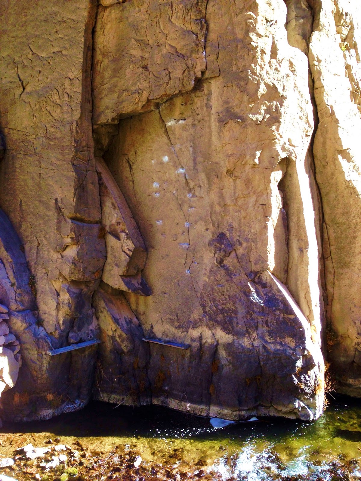
We arrived at the base of the North Arete by 9:30am, about 3 and a half hours after leaving the trail head. The final portion of the approach did involve crossing a final snowfield to the head wall of the route. This can be seen in the pictures above. It was a little spicy trying to cross the bullet hard snow without an crampons but the sun cups allows a somewhat non slip surface to cross. In the annotation picture below, the first pitch was covered by snow, We began our first roped pitch at the section labeled "5.7". 


Above: Annotated route picture - Photo Credit: Mark Thomas
Below: The North Arete was quite the site and really intimidating!


Here is a breakdown of the climb for us:
  1. Snow covered.
  2. Follow: 5.7 sustained james and stemming.
  3. Lead: Steep flakes lead to a low angle chute with bad rope drag.
  4. Follow: Blocky low angle arete.
  5. Lead: Low angle corner.
  6. Followed: Crux pitch, not that bad. Just chimney/stemming.
  7. Lead: Tunnel through pitch, low angle.
  8. Followed: Low angle, lots of rope drag.
  9.  The rest of the climb we unroped and soloed. Too blocky with drag.


Above: Looking up Pitch 1.
Below: Matt being from the east coast had.....tri cams (gasp!)


Above: The crux pitch 5.8
Below: Halfway up the route the Northeast ridge joins.


Above: Looking back from our pitch 8 I believe. The crux pitch passed the tower on east side, after that is honestly pretty low angle terrain from there on out.
Below: Eventuality, the North Arete and Northeast ridge join up to finish at the summit. Seen below is flakes and block madness until the summit. Since we had unroped long ago we opted for the 4th/Easy 5th bypass on the west side of the ridge.


Above: 3pm - Summit. The summit boulder is an unprotected 5.6 mantle. I tried for 5 minutes trying to figure out a piece of protection on to find it pointless. Matt is seen waiting patiently for me to summit and come back down.
Below: From the summit looking north towards Merriam Peak, Royce Peak, and Feather Peak.


Above: You'll have to excuse the summit photo. This was my "Go Pro" phase. Where are the videos you ask? I'd like to know myself...can't find them anywhere.
Below: The descent involves a rappel of the summit block down about 100' back to 3rd class ledges. From there its about 800' of talus and scree on the west side of the BCS towards a notch in which you can either rappel again of take your chances in a very dirty loose gully. Seen below is Matt after we finished the last rappel and began the 2 and a half miles of talus back towards the trail.


The photo above was taken almost at 4:30. This was last photo I took for the day and from there time really started to blur. We eventually reached the Mosquito Flat trail head at 9:00pm, 15 hours after starting. Only my day on the West Face of Mt. Williamson which was 17 tent to tent was longer. The last hour out was via headlamp and I recall the mosquitoes by the lakes being horrendous! Matt and I parted ways at the trail head. I had the long trek of driving home in front of me. I stopped at the McDonald's in Mammoth and ate 2 Big Mac burgers in my car. I don't think I had ever done that before nor have I done that since. Now one of the strangest things happened to me on the drive home that night. When I tell this story to some people, they think I was hallucinating due to my extreme fatigue from the day... no way man... this happened.
I crossed the Tioga Pass gate entrance around midnight and there was zero traffic on the road that night. Somewhere past Tenya lake, I was driving down a straight section and I see some people flagging me down with flashlights. I begin to slow and see that their car is broken down and perhaps 5 of them are standing out by it. As my lights being to show more of them I can see they're all wearing dark monk outfits. Seriously, I can even see the light reflecting on their crosses around their necks. This was obviously a strange sight to be seen at 1am on the middle of nowhere. I slow down and roll down my window and one of them politely asks for a ride to one of the campgrounds where others are waiting. I agree and 3 of them pile in my car and we take off towards a campground. They explain they're from El Paso TX on a road trip meeting others. After about an hour I arrive at a campground where strangely there are other monks there awake and excited to see them. I bid them farewell and drive off home. Strange huh? It happened.

Stats:
Car to Car time: 15 hours
Roped pitches: 8, could probably solo the last two.
Distance: 12 miles round trip, 5 being XC
Rack: Half Rope, gear to 3" lots of double length slings.
Gain: 3,700'