- Mt. Whitney
- Mt. Muir
- Mt. Russell
- Mt. Williamson
- Middle Palisade
- Mt. Sill
- Mt. Shasta
- Mt. Langley
- White Mountain
- Mt. Tyndall
- Split Mountain
- North Palisade
We both attempted North Palisade 3 times with no luck. Russ summited Split Mountain but has not done Mt. Russell and the reverse for me. It's not that the mountains are particularly that hard (North Palisade being the only technical rock, Shasta as a technical snow climb) it is mostly a TIME investment to get to the eastern Sierra. We talked many times about just day hiking the ones we can too maximize our time one the eastern Sierra with limited time off from work. With only about 1 week notice Russ called up with the idea of bagging Langley and White Mountain. After all our years of driving the 5 to 6 hours from Fresno to the east side we've dialed down our technique. We now split from Fresno in the late afternoon and drive back in the evening. Russ owns a Honda Pilot which is surprisingly comfortable to sleep in the back with the seats down. We'll now just crash out at the trail head and get up early to begin the day. This idea replaces the marathon drive plus hike in to where ever. A common theme on eastern Sierra trail heads is the heat mid day, so getting a early morning start really helps.
The Plan:
- Assuming I didn't get called out to work, split town around 4pm, drive to the eastern Sierra and crash out at the New Army Pass trail head at Horseshoe meadow.
- Day hike Mt. Langley via the south slopes (Class 1) from New Army Pass.
- Drive from Horseshoe meadow back down into the Owens valley and up the other side in to the White Mountains to the "Locked gate ~ 12,000 feet" on the White Mountain road.
- Day hike White Mountain via the road (14 miles round trip), then drive back to Fresno.
I snapped this pic of White Mountain during this past winter while flying Fresno - Las Vegas.

Monday June 9th:
Russ and I bounce out of Fresno on time and 5 hours later find ourselves driving up the amazing Horseshoe meadow Road. This road leaves Lone Pine at 3,000' and climbs to 10,000'.

Tuesday June 10th:
Our alarm goes off at 3:30am. Brew coffee, bagel, take a crap, and in no time we're off on the New Army Pass trail at 4:15am.

It should be noted the difference between "New Army Pass" and "Army Pass". You see at one time there was a trail over Army Pass, but it has been abandoned. The northeastern aspect of Army Pass left it packed with snow all summer long and rockfall was a continuous hazard. However, the old pass is closer to Mt. Langley saving close to a mile each direction. Russ and I determined that we would stick to the known New Army Pass on the way up and take a look-see down the old pass on the way back to see if that was something we wanted to travel down.
The first few miles flew by in my headlamp. The trail is surprisingly mellow and gains only a few hundred feet in 3 miles to the first the Cottonwood Lakes.

Not long there after begins the climb up to New Army Pass at an elevation of ~12,300'. We arrived at the pass in a little under 4 hours since we started. Pretty good time so far and we could see the summit of Langley!

From the pass, there was an amazing use trail from a million people going to the top. 2 miles of use trail got to the base of some boulders about 500' feet below the summit plateau. My pace really slowed like it always does at high altitude and Russ powered on a head of me. This photo is taken looking SOUTH towards New Army pass. You can really see the "use" trail in the scree. Olancha Peak (12,133') is seen in the far distance.

After a long and slow slog I finally arrived at the summit of Mt. Langley marking my 8th California 14er! What I was not expecting the incredible north face drop off from the summit. In fact the view from the summit was one of the most impressive I'd seen, Russ agreed as well. 6:15 since we left the trail head.


We whipped a U-ey and started our way back down. As we approach the old army pass I peered over and saw a little snow but looked to be mostly clear. As it turned out we had to negotiate a couple of dicey snow patches and then a loose rubble trail back to the main trail. We decided it was not worth the extra hassle to go that way and didn't save anytime. When it was all said and done I got back to the car at 4:00pm exhausted from a long day.
Stats:
- 13:45 Car to car
- 17 miles round trip
- 4,000' of gain
We jumped in the pilot and cruised back to through Lone Pine and once again grabbed Subway sandwiches. The drive up highway 168 east from Big Pine was all new for Russ and I. We followed the signs to the Ancient Bristlecone Pine Forest and then continued on a dirt road for 18 long grueling miles (Hour and half trip) to a locked gate.

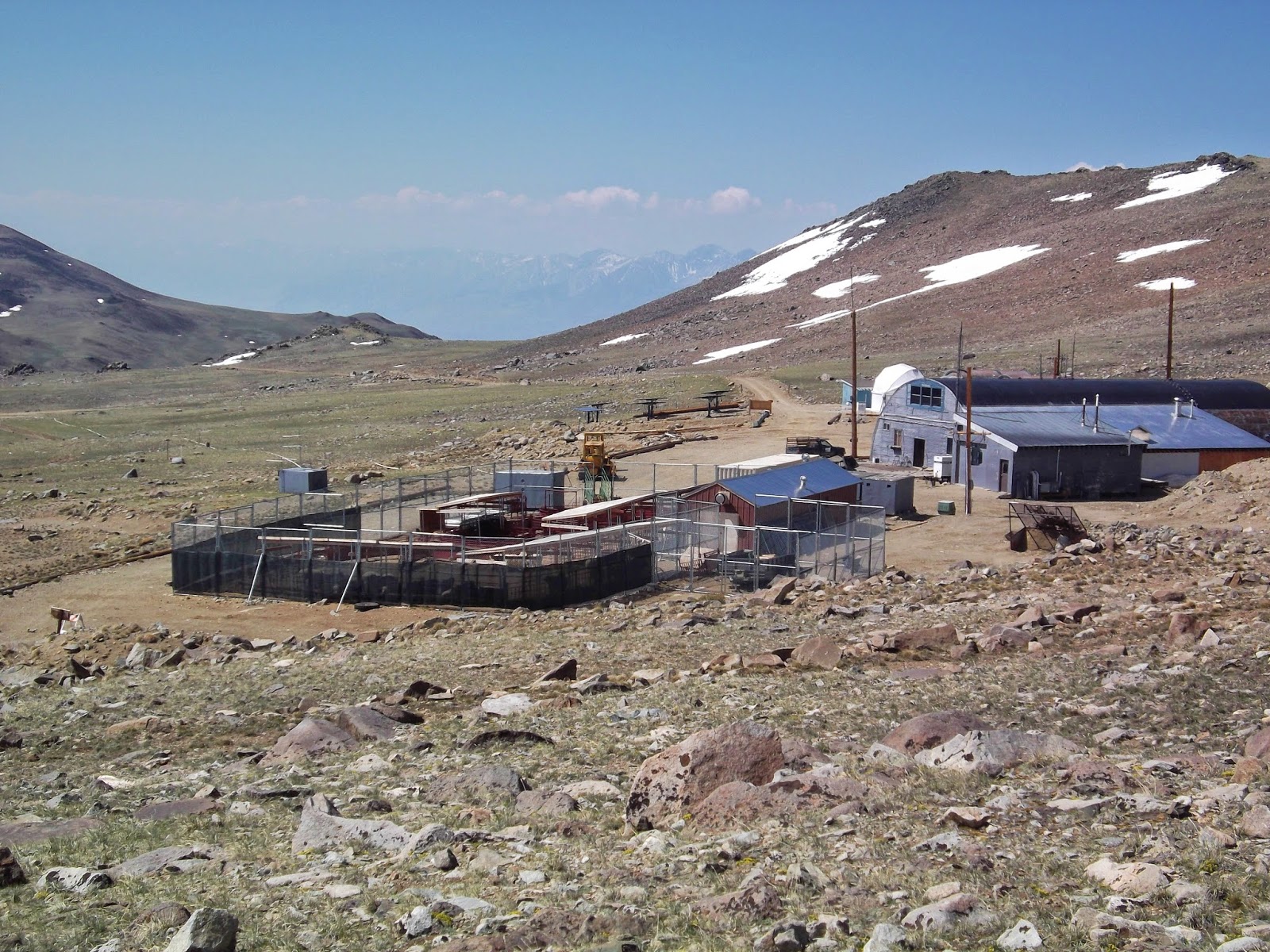
The reason for the lock gate is a few miles beyond is the Barcoft Research Center and I suppose they don't want more car traffic up there. Sitting at 12,000' this was to date the highest "trail head" I'd ever seen.

After my our long day and early start for Mt. Langley we both crashed out and prepared for another early AM.
Wednesday June 11th:
Another 3:30am alarm and we were off at 4:00am. The hike was the most straight forward I'd been on, just follow the road. A little after and hour of hiking we pass the research center and one of its observatories.


The weather was cool and was excellent was hiking. We followed the road up and down until the finish push to the summit. A little after 7:30am we topped out at the summit hut marking my 9th California 14er peak. Time since trail head 4:30.

Back down the road we went and the 7 miles seem to pass by fairly quickly.
Along the way I got a good look at the research station and "Area 51 for Sheep".

Stats:
- 7 hours Car to car
- 14 miles round trip
- 2,200' of gain